Upper Midwest Moderate Risk Today

There is a Moderate Risk for severe weather this afternoon and evening in parts of the far eastern Dakotas and western Minnesota. This includes Fargo, ND, Watertown, Aberdeen and Brookings, SD, and Moorhead and Marshall, MN.
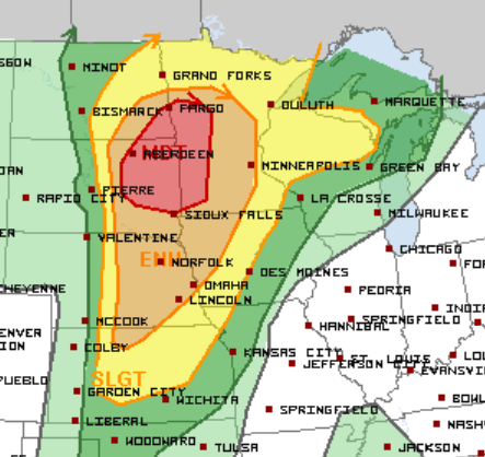
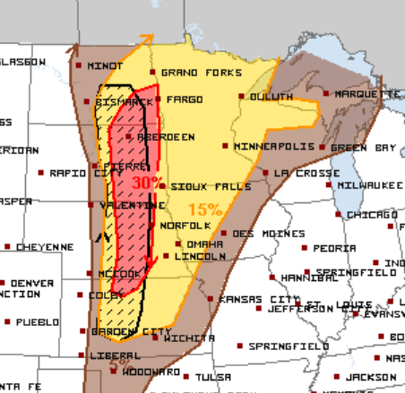
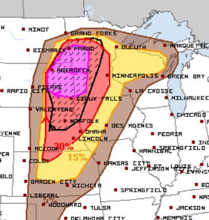
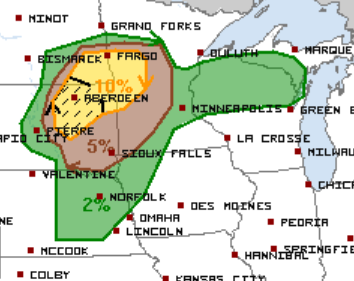
Very large hail to baseball sized, hurricane force wind gusts, and isolated tornadoes are all possible with initial storm development in the Moderate Risk area. The threat will then shift a bit to a damaging wind gust and embedded tornado threat as storms congeal into a line and move eastward through the evening. (Hail, wind, and tornado risk below)
Follow us on Twitter for updates and watch chaser live streams here.
What People Are Saying...
Twitter Mentions
Reddit
Jetpack Comments
Comments are closed here.