Upper Great Lakes Enhanced Risk
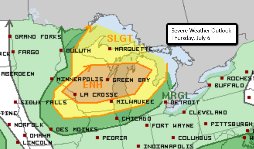
There is an Enhanced Risk for severe weather today across parts of the Upper Mississippi River Valley and Upper Great Lakes. This includes much of central Wisconsin and parts of northwestern Michigan.
A cold front will slide through this region later this afternoon and spark showers and thunderstorms. Dew points will be in the upper 60s/low 70s and temperatures in the 80s and 90s.
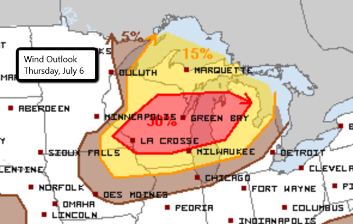
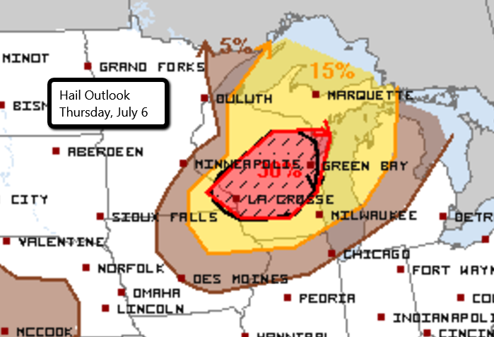
Large hail, damaging wind gusts, heavy rainfall, and even a few tornadoes will be possible with the strongest storms. Cities like Green Bay, Appleton, Oshkosh, La Crosse, and Sheboygan in Wisconsin need to stay sky aware today!
Follow us on Twitter for updates!
Watch chaser live streams here.
What People Are Saying...
Twitter Mentions
Reddit
Jetpack Comments
Comments are closed here.