Severe Weather Threat Continues in the Southeast
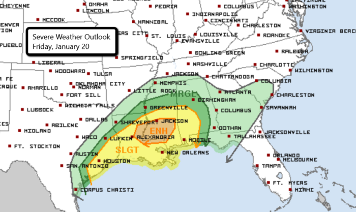
More severe weather is possible today across parts of the Gulf Coast from Texas to the Florida panhandle. Storms will start up this evening and continue into the overnight. Damaging wind gusts, large hail, and even a few tornadoes are possible with any cells that develop.
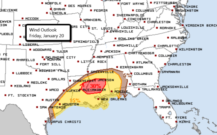
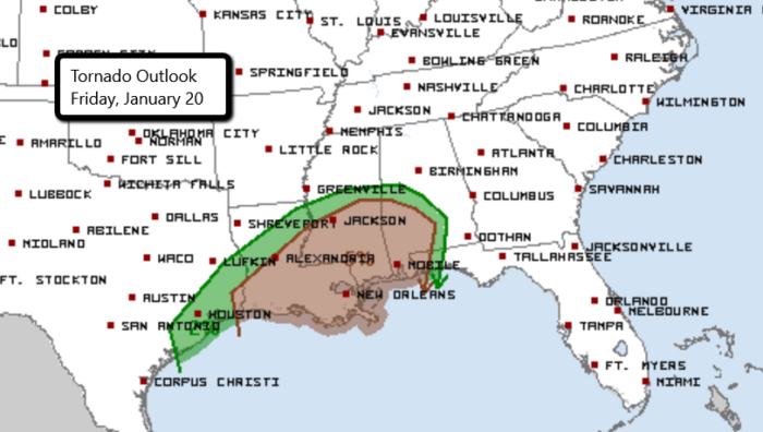
There is an Enhanced risk of severe weather for parts of Louisiana and Mississippi. This includes the cities of Jackson and Hattiesburg, MS. Some major cities in the Slight risk area include Houston, TX, New Orleans and Baton Rouge, LA and Mobile, AL.
The threat for severe storms will continue into the weekend as well for much of the Southeast. An Enhanced risk on Saturday includes Jackson, MS, Albany, GA, and Tallahassee and Pensacola, FL. Cities under a Slight risk include Memphis, TN, New Orleans, LA, Atlanta, GA, and Birmingham, AL. The severe threat spreads farther east on Sunday.
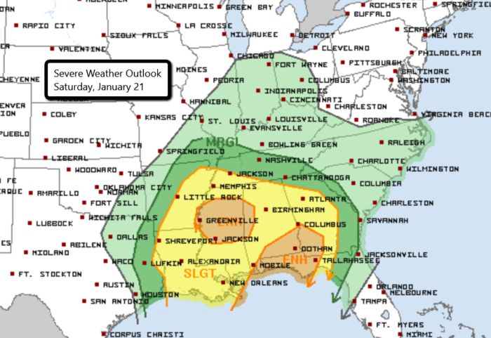
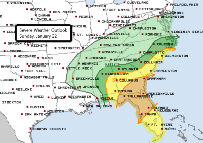
Severe weather will be possible after dark and in the overnight hours. Make sure you have a way to receive severe weather alerts even while sleeping!
Follow the severe weather LIVE with chasers in the field by clicking here.
For the latest information on this weekend’s weather, follow us on Twitter.

What People Are Saying...
Twitter Mentions
Reddit
Jetpack Comments
Comments are closed here.