Winter Storm Watch Posted for Parts of the Southeast
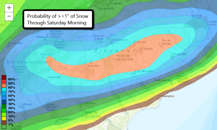
A storm system will bring cold temperatures and winter precipitation to parts of the Southeast Friday and Saturday. Snow, sleet, and freezing rain will all be possible. Winter Storm Watches have been posted from Alabama to Virginia.
Winter Wx Update: Watch EXPANDED, latest snowfall total updated. SIGNIFICANT impacts, including travel. #alwx https://t.co/lpHLOIriRL pic.twitter.com/TWODU1E3Pe
— NWS Birmingham (@NWSBirmingham) January 5, 2017
Birmingham, AL could pick up between 1 and 2 inches of snow and sleet from Friday morning to Saturday morning. Much of north Georgia, including the Atlanta area, could get 2-4″ of snow. The precipitation will start early Friday as a rain snow mix, but eventually change over to all snow by late Friday evening. The highest snow totals with this event will be possible in northeastern North Carolina and extreme southeastern Virginia. Some spots, including Norfolk, VA, could receive 4-6″ of snow.
NDFD Snowfall Forecast through Saturday night (Credit: WeatherBell)
Significant travel impacts are possible as snow will be falling in many locations during the Friday evening commute. For the latest forecasts, visit your local NWS office.
Follow us on Twitter for updates!


What People Are Saying...
Twitter Mentions
Reddit
Jetpack Comments
Comments are closed here.