Sally to Bring Dangerous Surge and Flooding
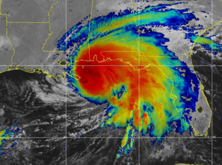
Hurricane Sally continues to slowly edge toward landfall along the Gulf Coast. The storm is moving northwestward at only about 2 mph.
This very slow movement could potentially lead to historic flooding along parts of the northern Gulf Coast. Life-threatening storm surge is also likely.
Current warnings for Hurricane Sally are as follows:
A Storm Surge Warning is in effect for…
* Mouth of the Mississippi River to the Okaloosa/Walton County Line
Florida
* Mobile Bay
A Hurricane Warning is in effect for…
* East of Bay St. Louis to Navarre Florida
A Tropical Storm Warning is in effect for…
* East of Navarre Florida to Indian Pass Florida
* Bay St. Louis westward to Grand Isle Louisiana
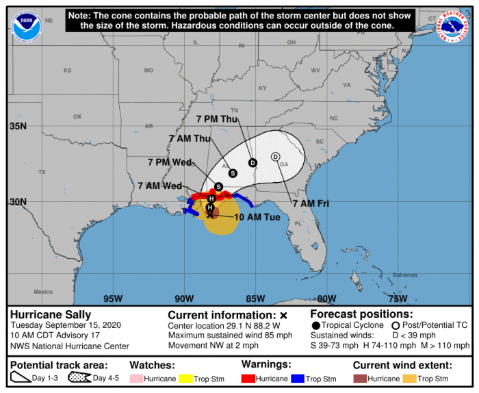
Sally is expected to make landfall along the Gulf Coast sometime late tonight or tomorrow morning.
A tornado watch is in effect for parts of Alabama and the Florida panhandle today. Tornadoes will be possible as Sally continues to edge closer to shore.
Follow us on Twitter for updates.
What People Are Saying...
Twitter Mentions
Reddit
Jetpack Comments
Comments are closed here.