Michael Poses High Surge Threat
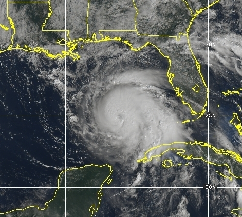
Hurricane Michael continued to strengthen last night and is now a category 2 storm with maximum sustained winds of 110 mph. It’s currently about 360 miles south of Panama City, FL.
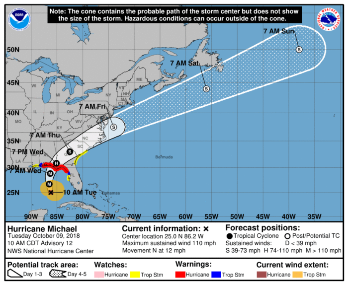
Michael will continue to move towards the Gulf Coast in the coming days. A hurricane warning is in effect from the Alabama-Florida border to Suwannee River, FL. A storm surge warning is in effect from the Okaloosa-Walton county line in Florida to Anclote River, FL.
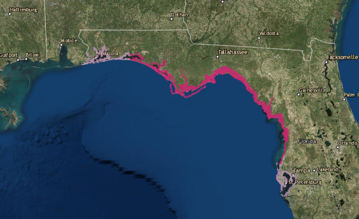
Storm Surge watches (purple) and warnings (pink).
Storm Surge Forecast from the National Hurricane Center:
Indian Pass FL to Cedar Key FL...8-12 ft
Cedar Key FL to Crystal River FL...6-8 ft
Okaloosa/Walton County Line FL to Indian Pass FL...6-9 ft
Crystal River FL to Aripeka FL...4-6 ft
Aripeka FL to Anna Maria Island FL including Tampa Bay...2-4 ft
Alabama/Florida border to Okaloosa/Walton County Line FL...2-4 ft
Life-threatening storm surge, heavy rainfall and flash flooding, strong winds and tornadoes will all be possible for those living along the Florida panhandle.
If you live in or near these areas, continue to closely monitor forecast changes and listen to all evacuation orders.
Follow us on Twitter for updates.
What People Are Saying...
Twitter Mentions
Reddit
Jetpack Comments
Comments are closed here.