South Florida under Hurricane Warning
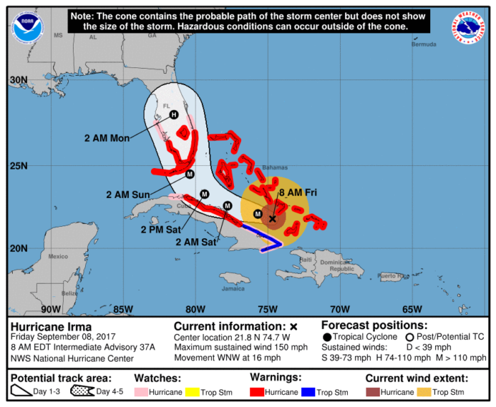
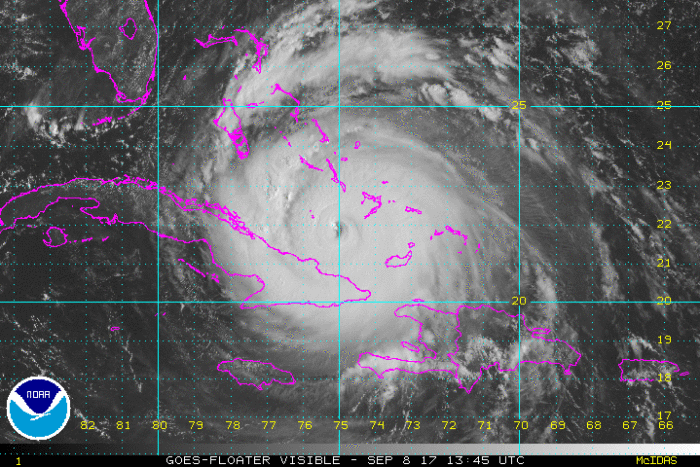
As of 8 AM ET today, Hurricane Irma is a strong Category 4 hurricane with maximum sustained winds of 150 mph. The storm is sitting about 450 miles southeast of Miami, FL and is moving west northwest around 16 mph.
A Hurricane Warning is in effect for the Florida Keys and both coasts of Florida from Jupiter Inlet around the peninsula to Bonita Beach. A Storm Surge Warning is also in effect for the same areas. The eye of Irma is expected to be near the Keys and southern Florida coast sometime Sunday morning.

It is important to note that both coasts of Florida will see impacts, not just areas near landfall, because of the size of Irma. Everyone along Florida’s southern coasts should be prepared for life threatening storm surge and hurricane force winds.
Florida Governor, Rick Scott, has closed all K-12 public schools, state colleges, state universities, and state offices from Friday to Monday. He had previously declared a state of emergency for the state earlier in the week.
Although Irma has weakened to a Category 4 hurricane, it is still a very dangerous storm. It is imperative that if you live in Warning areas that you follow all orders from local officials, including the order to evacuate. Irma is expected to remain in favorable conditions over the next few days and will maintain it’s Category 4 status.
Stay tuned for updates.


What People Are Saying...
Twitter Mentions
Reddit
Jetpack Comments
Comments are closed here.