Hurricane Warnings for Tropical Storm Harvey
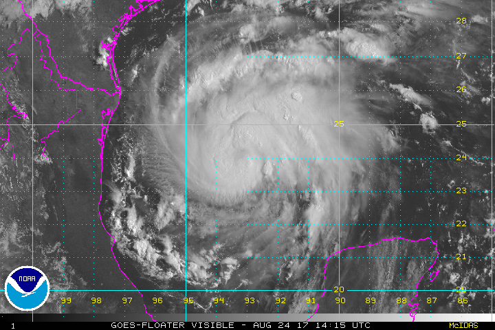
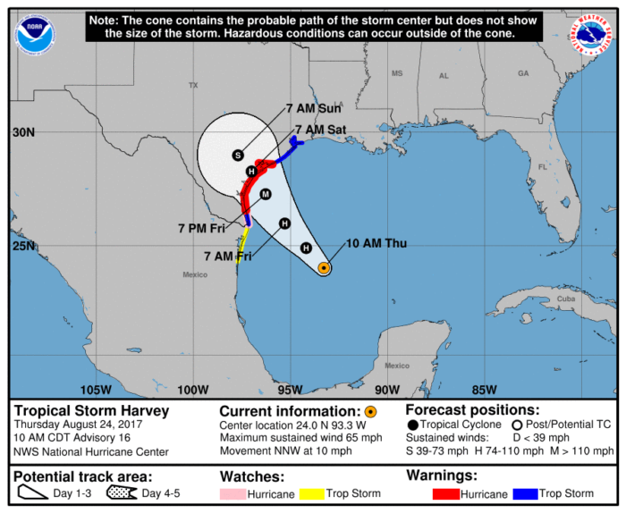
Hurricane Watches issued yesterday have been upgraded to Hurricane Warnings as Tropical Storm Harvey continues to churn in the Gulf of Mexico. The Hurricane Warning extends from Port Mansfield to Matagorda, TX. A Storm Surge Warning is in effect from Port Mansfield to San Luis Pass, TX.
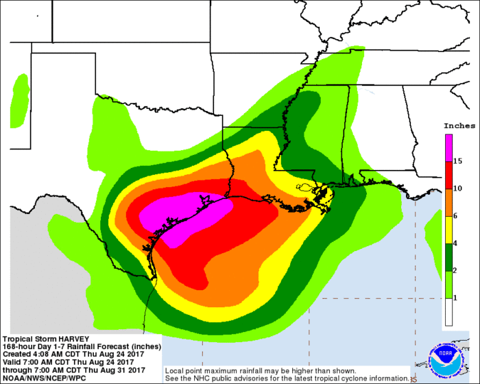
The main hazard for those in warning areas is the threat for deadly flooding. Very heavy rainfall is expected as Harvey approaches and eventually makes landfall along coastal Texas. Anywhere from 12-20″ of rain is possible with some spots potentially seeing 30″ of rain through Wednesday. This could lead to life threatening flooding.
Texas Governor Greg Abbott declared a state of disaster for 30 counties on Wednesday in anticipation of Harvey’s arrival.
Harvey is continuing to strengthen and could reach major hurricane status within the next 36 hours. Areas within the Hurricane Warning need to complete preparations as soon as possible. Landfall is expected sometime early Saturday morning along the middle Texas coast.
Stay tuned for updates.
What People Are Saying...
Twitter Mentions
Reddit
Jetpack Comments
Comments are closed here.