Franklin to Make Landfall Tonight
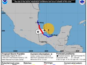
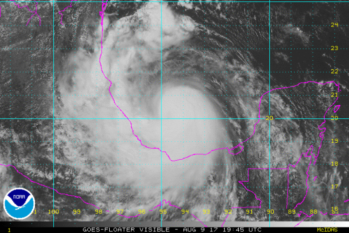
What is currently Tropical Storm Franklin is expected to make landfall tonight along Mexico’s eastern coast as a hurricane. There are currently hurricane warnings in place from Puerto de Veracruz to Cabo Rojo.
The center of Franklin is expected to strengthen later today and make landfall tonight as a hurricane somewhere along the coast of the state of Veracruz. Franklin will then continue to move inland early tomorrow morning.

As of 1 PM CT, maximum sustained winds were near 70 mph with higher gusts. Tropical storm force winds extended outward up to 140 miles from Franklin’s center.
As Franklin moves ashore, the greatest threat will be life threatening flash flooding and mudslides. Rainfall totals of 4-8″ and isolated 15″ amounts are possible in the states of Tabasco, Veracruz, Puebla, Tlaxacala, Hidalgo, Queretar, and San Luis Potosi.
Franklin will also bring strong winds that could down trees and damage structures. Storm surge will raise water levels by 4-6 feet and bring dangerous waves to coastal areas near to where the storm makes landfall.


What People Are Saying...
Twitter Mentions
Reddit
Jetpack Comments
Comments are closed here.