Active Weather to End the Week
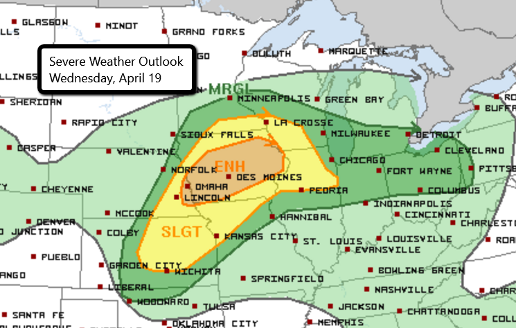
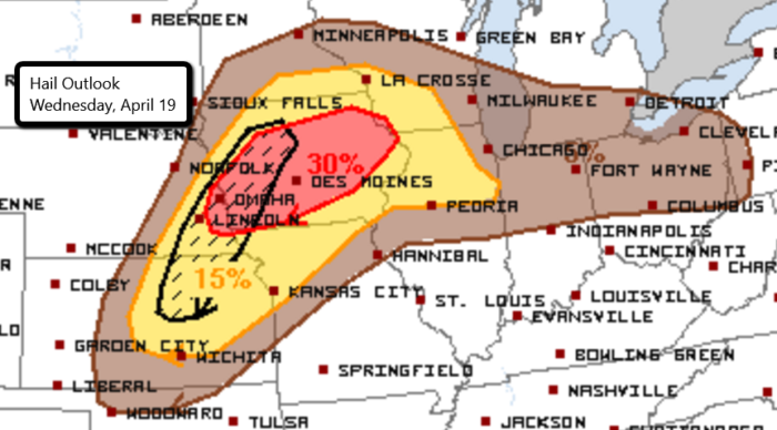
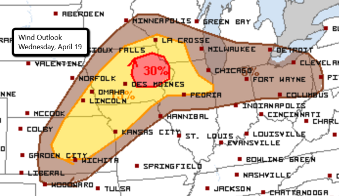
Severe thunderstorms will be possible over the next few days across parts of the country. Today’s threat is centered over Iowa with an Enhanced Risk in place. This includes Des Moines, Waterloo, Iowa City, and Cedar Rapids in Iowa as well as Omaha, NE. There is also a Slight Risk in place from northeast Kansas into southwest Wisconsin.
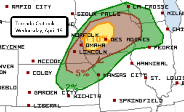
Large hail, damaging winds, and even a few tornadoes will be possible in these areas. The greatest potential for tornadoes is in western Iowa, including Des Moines and Ames.
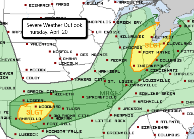
The active weather continues tomorrow with two Slight Risk areas. One includes parts of the Texas panhandle and Oklahoma and the other is over parts of the Great Lakes. Hail and strong winds will be the greatest threats with a tornado or two also possible.
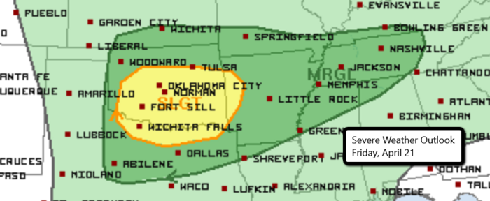
Wrapping up the work week, we’ll see the potential for more strong storms in Oklahoma, Texas, and Arkansas. All severe threats will be possible. Stay tuned for updates!
Watch live chaser streams here!
Follow us on Twitter for updates.
What People Are Saying...
Twitter Mentions
Reddit
Jetpack Comments
Comments are closed here.