Enhanced Risk of Severe Weather for Ozark Plateau
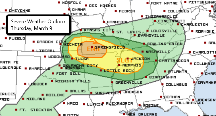
Severe weather is possible today from parts of eastern Kansas into northwest Alabama. An Enhanced risk is in place over the Ozark Plateau, including Springfield, MO. Large hail, damaging wind gusts, and a few tornadoes are possible.
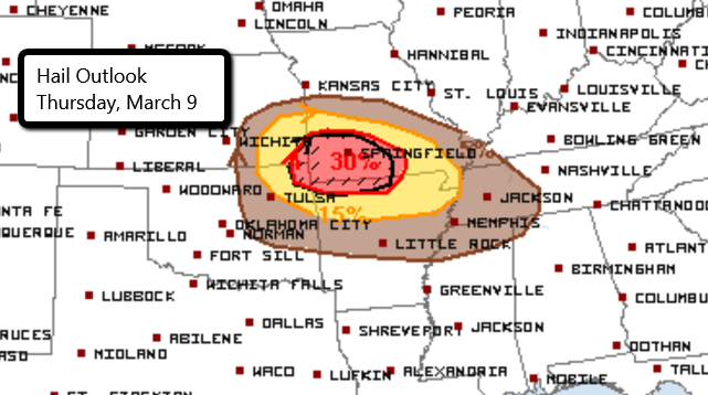
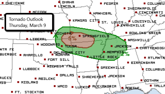
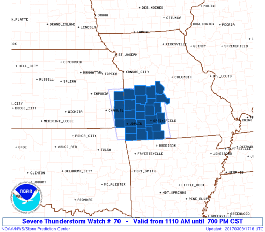
Thunderstorms are already ongoing this morning and will continue into the afternoon and evening. A Severe Thunderstorm is in place until 7 PM CST for parts of Kansas and Missouri. Storms that develop in this area could produce very large hail up to 2.5″ in diameter, wind gusts to 65 mph, and a tornado or two.
Follow us on Twitter for updates.
Check out our chasers’ live streams here!
What People Are Saying...
Twitter Mentions
Reddit
Jetpack Comments
Comments are closed here.