Enhanced Risk of Severe Weather for Gulf Coast States
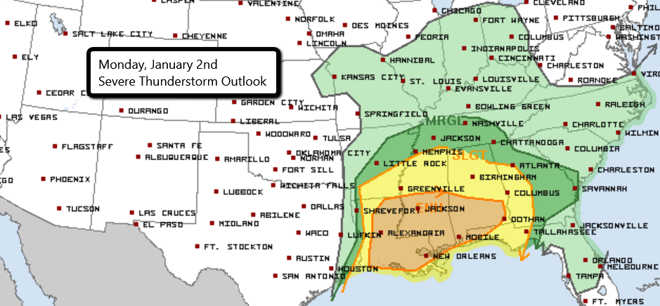
While many people across the country are enjoying a day off to celebrate the new year, the Weather is still hard at work. There is an Enhanced Risk of severe weather today from Louisiana to southern Alabama and the Florida panhandle. A strong short-wave moving through Texas has already caused severe storms to develop this morning, with reports of wind damage in the Dallas-Fort Worth area.
Areas south of a warm front draped from southwest Louisiana into northwest Florida have dewpoints approaching 70F as well as warm surface temperatures. With the abundance of moisture, very heavy rain will be likely. Damaging wind gusts continue to remain the primary severe threat with any storms that develop. However, a few tornadoes cannot be ruled out, especially for eastern Louisiana and far southern Mississippi and Alabama.
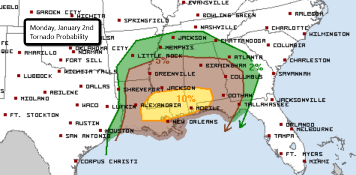
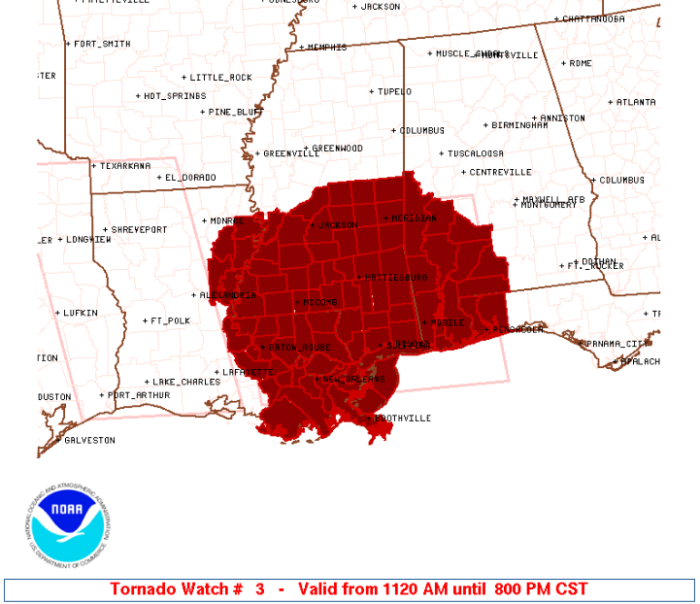
A Tornado Watch has already been issued for these locations. A few tornadoes, wind gusts to 75 mph, and isolated hail to 1.5″ will all be possible. This Watch is in effect until 8 PM CT.
Chasers are already out across the risk area. Watch their streams LIVE here.
Follow us on Twitter for the latest updates!
What People Are Saying...
Twitter Mentions
Reddit
Jetpack Comments
Comments are closed here.